- CURRENT LOCATION: HOME
- >> About Shaanxi
- >> Global Associations
- >> Sister Cities
- >>
- Shaanxi
Mato Grosso (Brazil)
2017-04-10 16:02:11 , Source : The Government Website of Shaanxi Province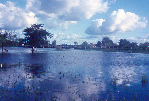
Mato Grosso is one of the states of Brazil, the third largest by area, located in the western part of the country.
Neighboring states are (from west clockwise) Rondônia, Amazonas, Pará, Tocantins, Goiás and Mato Grosso do Sul. It also borders Bolivia to the southwest. A state with a flat landscape, alternating great chapadas and plain areas, Mato Grosso presents three different ecosystems: Cerrado, Pantanal and the Amazon Rainforest. The vegetation of the open pasture covers 40% of the state, and the Chapada dos Guimarães National Park, with its caves, grottos, tracks and waterfalls, is one of its great tourist attractions. In the north is the Amazonian forest, with a biodiversity originally covering half of the state, currently largely devastated for logging, agricultural purposes and pastures. The Xingu National Park and the Araguaia River are in Mato Grosso. Further south, the Pantanal, the world's largest wetland, is the habitat for almost a thousand species of animals, with many aquatic birds.
Geography
Located in the Mato Grosso is the Chapada dos Guimarães, a unique environment made from sandstone mountains and their subsequent erosion. The terrain of the Mato Grosso is varied and includes cliffs, canyons, and waterfalls.
The biologically rich Pantanal, one of the world's largest wetland/prairie ecosystems, is also located within this state. Much environmental degradation has occurred to the Pantanal within the past few decades, and it shows no sign of stopping anytime soon. The Pantanal can be compared to the Everglades in Florida, as both share much in common, habitat wise, although the Pantanal is of much larger scale.
History
In 1977, the state was split into two halves, with Mato Grosso do Sul becoming a new state. The Bororo Indians live in the Mato Grosso area. As late as 1880, soldiers patrolled lands on the outskirts of Cuiabá, Mato Grosso's capital and largest city, to protect settlers from Bororo raids.
By the end of the 19th century, although severely reduced by disease and by warfare with explorers, slave traders, prospectors, settlers, and other indigenous groups, as many as five to ten thousand Bororo continued to occupy central and eastern Mato Grosso, as well as western Goiás. The southwestern part of it was ceded to Bolivia in exchange for Acre, according to Treaty of Petrópolis in 1903.
The historic remoteness of this area led it to be the subject of exploration, most notably by Captain Percy Fawcett, in the quest for lost cities. It was also the rumored location of access to the interior of the earth in various Hollow Earth theories.
Demographics
Mato Grosso had a high rate of population growth in the 20th century. Despite this, the state as a whole has one of the lowest population densities of any Brazilian state. According to the IBGE of 2008, 3,010,000 people resided in the state. The population density was 3.2 inh./km².
Urbanization: 76.6% (2006); Population growth: 2.4% (1991–2000); Houses: 836,000 (2006).
Ethnically, the state includes a relatively high proportion of caboclos (persons of mixed European and Indian ancestry), as do other areas of the interior. The last PNAD (National Research for Sample of Domiciles) census revealed the following numbers: 1,532,000 Brown (Mixed) people (50.92%), 1,179,000 White people (39.16%), 239,000 Black people (7.93%), 41,000 Amerindian people (1.37%), 14,000 Asian people (0.45%).
Culture
The local culture is very rich, due to the influences of and encounters with various cultures, such as Native Americans, the original settlers, the Africans enslaved originally by the Portuguese, and Europeans, beginning with the Portuguese settlers and other European immigrants who arrived later. Two long periods of isolation also contributed to its differentiation, which has been somewhat diluted by recent immigration. Cuiabá has an interesting cuisine influenced by natives, with their typical dances, craftwork, and music.
Dance and music were traditionally connected to the worship of Catholic saints and their festivals, Saint Benedict (the city's patron), being one of the favorite.
Tourism and recreation
Alta Floresta
Fishing in the Teles Pires, São Benedito and Azul rivers is productive practically all year long.
Bird watching: with the more than 570 species of catalogued birds and new species being discovered every year, the region of Alta Floresta, Cristalino and Azul River Basin receives constant visits from famous ornithologists and bird watchers.
Chapada dos Guimarães
The largest sandstone cavern in Brazil, Aroe Jari, extends nearly 1550 meters and several prehistoric inscriptions can be found inside.
North Pantanal
The Pantanal's backbone is the Paraguay River, which cuts through the region from north to south. The Miranda, Aquidauna, Taquari and Cuiaba rivers flow into the Paraguay River. From October to April, the high waters reveal outsized lakes, bays, river branches and outlets.
The Transpantaneira Highway connects the town of Pocone to Jofre Port, along the Cuiabá River bank. It is a dirt road with 126 wooden bridges, and extends for 149 km. On the way, it is possible to observe wild animals, especially alligators, capybaras and birds, among other wild animals.
SESC's Private Natural Heritage Reserve (RPPN) increases by one-third the total area of this preserved ecosystem in the State of Mato Grosso.
Over 160 different species of birds have been observed in the Pantanal, and still many species in the area have not yet been identified.
Águas Quentes State Park
The 1,487 hectares (3,670 acres) Águas Quentes State Park, the first protected area in Mato Grosso, is known for the healing powers of its thermal waters.

Government Organizations

Other Links

Copyright@www.shaanxi.gov.cn All Rights Reserved
Registration Number:陕ICP备10004160号